Kujawsko-Pomorska Digital Library contains 263 781 digital objects
Object
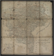
Title: Karte vom Grosherzogthum Posen / aus der Gillyschen Karte von Südpreylsen reducirt und gezeichnet, vom Regierungs Secretair Premier Lieutenant Peschell
Description:
1 mapa : kolor., podklejona płótnem. ; 67 x 63 cm. ; Skala oryginalna: [5 mil - 7,4 cm]. ; W prawym dolnym rogu: Statistische Tabelle der in zwey Regierungs Departaments eingetheilten 26 Kreise zum Departement von Posen Bromberg gehören.
Publisher:
Place of publication:
Format:
Source:
Language:
Rights:
Domena publiczna (Public domain)
Access Rights:
Resource Identifier:
Digitalisation:
Wojewódzka i Miejska Biblioteka Publiczna w Bydgoszczy
Original in:
Wojewódzka i Miejska Biblioteka Publiczna w Bydgoszczy
Sponsor:
Projekt e-Kultura WZP.273.55.2014
Object collections:
- Kujawsko-Pomorska Digital Library > Cultural heritage > Maps
- Kujawsko-Pomorska Digital Library > Recommended
- Kujawsko-Pomorska Digital Library > Collections of project partners > Voivodeship and Municipal Public Library of Dr. Witold Bełza in Bydgoszcz
Last modified:
Nov 15, 2023
In our library since:
May 16, 2016
Number of object content hits:
145
Number of object content views in DjVu format
147
All available object's versions:
https://kpbc.umk.pl./publication/156334
Show description in RDF format:
Show description in OAI-PMH format:
Objects Similar
Polska. Główny Urząd Statystyczny. Referat Kartograficzny
Handtke, Friedrich H. (1815-1879) Flemming, Carl Ferdinand
Teslar, Tadeusz (1894-1969) Hryniewicki, Olgierd Wraga, Ryszard (1902-1968)
Gräf, Carl (1822-ca 1897) Müller, A. Geographisches Institut (Weimar)
Neumann


