Kujawsko-Pomorska Digital Library contains 262 795 digital objects
Object
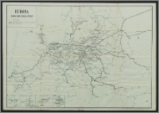
Title: Europa : mapa sieci kolejowej
Description:
1 mapa : kolor. ; 94 x 65 cm. ; Skala nieokreślona. ; Nie opisana siatka kartograficzna, brak oznaczenia rzeźby terenu. ; Mapy poboczne : połączenia kolejowe - A. Jezioro Bodeńskie ; B. Frankfurt - Karlsruhe ; C. Zagłębie westfalsko-nadreńskie ; D. Zagłębie śląskie.
Contributor:
Publisher:
Zarząd Główny Związku Prac. Poczt., Telegraf. i Telefonów Rzeczp. Polskiej
Place of publication:
Format:
Source:
Language:
Rights:
Domena publiczna (Public domain)
Access Rights:
Resource Identifier:
Digitalisation:
Wojewódzka i Miejska Biblioteka Publiczna w Bydgoszczy
Original in:
Wojewódzka i Miejska Biblioteka Publiczna w Bydgoszczy
Sponsor:
Projekt e-Kultura WZP.273.55.2014
Object collections:
- Kujawsko-Pomorska Digital Library > Cultural heritage > Maps
- Kujawsko-Pomorska Digital Library > Recommended
- Kujawsko-Pomorska Digital Library > Collections of project partners > Voivodeship and Municipal Public Library of Dr. Witold Bełza in Bydgoszcz
Last modified:
Nov 15, 2023
In our library since:
Jun 6, 2016
Number of object content hits:
103
Number of object content views in DjVu format
107
All available object's versions:
https://kpbc.umk.pl./publication/156836
Show description in RDF format:
Show description in OAI-PMH format:
| Edition name | Date |
|---|---|
| Europa : mapa sieci kolejowej | Nov 15, 2023 |
Objects Similar
Post-, Reise- und Eisenbahn-Karte von Deutschland, der Schweiz, den Niederlanden und Belgien : nebst Theilen der angrenzenden Länder [...] Kunsch, H. Handtke, Friedrich H. (1815-1879) Verlag von Carl Flemming (Głogów)
Hermann, M. Verlag von Carl Flemming (Głogów)


