Kujavisch-Pommersche Digitale Bibliothek contains 262 816 digital objects
Object
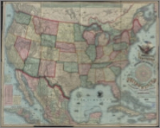
Title: Topographical and railroad map of the United States : british possessions, West Indies, Mexico, and Central America
Beschreibung:
1 mapa : litogr. kolor., podklejona płótnem. ; 117 x 95 cm, złoż. w okł. 31 x 25 cm. ; Skala [ca 1:4 320 000]. ; Mapa poboczna: Central America. ; Z prawej strony, pomiędzy tytułem tabela: Time and distance table between Washington and the principal places in north and central America. ; Rzeźba przedstawiona metodą kreskową.
Herausgeber:
Verlagsort:
Format:
Quelle:
Sprache:
Rechte:
Domena publiczna (Public domain)
Zugriffsrechte:
Identifikation des Bestandes:
Digitalisierung:
Wojewódzka i Miejska Biblioteka Publiczna w Bydgoszczy
Besitzen:
Wojewódzka i Miejska Biblioteka Publiczna w Bydgoszczy
Sponsor:
Projekt e-Kultura WZP.273.55.2014
Object collections:
- Kujawsko-Pomorska Digitale Bibliothek > Kulturelles Erbe > Karten
- Kujawsko-Pomorska Digitale Bibliothek > Empfohlen
- Kujawsko-Pomorska Digitale Bibliothek > Sammlungen von Projektpartnern > Woiwodschafts- und Stadtbibliothek von Dr. Witold Bełza in Bydgoszcz
Last modified:
15.11.2023
In our library since:
29.06.2016
Number of object content hits:
35
Number of object content views in DjVu format
38
All available object's versions:
https://kpbc.umk.pl./publication/158456
Show description in RDF format:
Show description in OAI-PMH format:
| Edition name | Date |
|---|---|
| Topographical and railroad map of the United States : british possessions, West Indies, Mexico, and Central America | 15.11.2023 |


