Kujawsko-Pomorska Digital Library contains 263 821 digital objects
Object
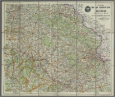
Title: Amtliche Karte des Gaues 37, Oberschlesien des D. R. B ; Amtliche Rad- und Autofahrer - Karte von Oberschlesien
Description:
1 mapa : kolor. ; 55x65 cm, ark. 58x68 cm, w okł. 23x13 cm. ; 1:300 000. ; Tyt. z okł. ; [Oprac.] Nach den neuesten offiziellen Unterlagen, unter Mitwirkung der Gauverbände des Deutschen Radfahrerbundes u. à Consulate der Allgem. Radfahrer Union bearbeitel und herausgegeben. ; Rzeźba terenu: punkty wysokości. ; Verso: blanco.
Contributor:
Mittelbach, Robert (?-1916 ; Bund Deutscher Radfahrer (Lipsk) ; Mittelbach's Verlag (Lipsk) ; Graphische Kunstanstalt "Globus" (Drezno)
Publisher:
Mittelbach's Verlag ; Kunstanstalt "Globus"
Place of publication:
Leipzig ; Dresden-Kötzschenbroda
Format:
Source:
Language:
Relation:
Rights:
Domena publiczna (Public domain)
Access Rights:
Resource Identifier:
Digitalisation:
Wojewódzka i Miejska Biblioteka Publiczna w Bydgoszczy
Original in:
Wojewódzka i Miejska Biblioteka Publiczna w Bydgoszczy
Sponsor:
Projekt e-Kultura WZP.273.55.2014
Object collections:
- Kujawsko-Pomorska Digital Library > Cultural heritage > Maps
- Kujawsko-Pomorska Digital Library > Recommended
- Kujawsko-Pomorska Digital Library > Collections of project partners > Voivodeship and Municipal Public Library of Dr. Witold Bełza in Bydgoszcz
Last modified:
Nov 15, 2023
In our library since:
Nov 23, 2016
Number of object content hits:
102
Number of object content views in DjVu format
105
All available object's versions:
https://kpbc.umk.pl./publication/167783
Show description in RDF format:
Show description in OAI-PMH format:
| Edition name | Date |
|---|---|
| Amtliche Karte des Gaues 37, Oberschlesien des D. R. B | Nov 15, 2023 |
Objects Similar
Wojskowy Instytut Geograficzny
Instytut Kartograficzny i Wydawniczy "Glob" J. Chodorowicza
Gotz, Marceli Walkiewicz, Władysław


