Kujawsko-Pomorska Digital Library contains 262 816 digital objects
Object
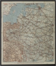
Title: Kriegskarte Westliches Russland und angrenzende mitteleuropäische Gebiete
Description:
1 mapa : litogr. kolor. ; 84x72 cm, na ark. 90x76 cm. ; Massstab 1:2 000 000. ; Aus dem Eisenbahn- und Verkehrs-Atlas von Europa, begründet von Dr. W. Koch und C. Opitz. ; Verso: reklamy wydawnictw Oskar Eulitz Verlag.
Contributor:
Publisher:
Place of publication:
Format:
Original identifier:
Language:
Rights:
Domena publiczna (Public domain)
Access Rights:
Resource Identifier:
Digitalisation:
Wojewódzka i Miejska Biblioteka Publiczna w Bydgoszczy
Original in:
Wojewódzka i Miejska Biblioteka Publiczna w Bydgoszczy
Sponsor:
Projekt e-Kultura WZP.273.55.2014
Object collections:
- Kujawsko-Pomorska Digital Library > Cultural heritage > Maps
- Kujawsko-Pomorska Digital Library > Recommended
- Kujawsko-Pomorska Digital Library > Collections of project partners > Voivodeship and Municipal Public Library of Dr. Witold Bełza in Bydgoszcz
Last modified:
Nov 15, 2023
In our library since:
Jan 31, 2017
Number of object content hits:
121
Number of object content views in DjVu format
122
All available object's versions:
https://kpbc.umk.pl./publication/175712
Show description in RDF format:
Show description in OAI-PMH format:
| Edition name | Date |
|---|---|
| Kriegskarte Westliches Russland und angrenzende mitteleuropäische Gebiete | Nov 15, 2023 |
Objects Similar
Ravenstein, Hans (1866-1934) Ravenstein Geographische Verlagsanstalt und Druckerei Polen, nördliche Hälfte gegen Posen und Westpreussen
Ravenstein, Hans (1866-1934) Ravenstein Geographische Verlagsanstalt und Druckerei
Wojskowy Instytut Geograficzny


